Discussion - Member to Member Sales - Research Center
Discussion - Member to Member Sales - Research Center


Login to Like
this post
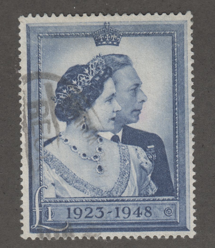
I never got into GPS and have always relied on a map - but maps on stamps are a passion for me.

1 Member
likes this post.
Login to Like.
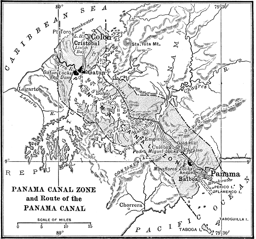
My father is a civil engineer and worked for the Panama Canal. Maps were always around.
Login to Like
this post
Phil, your map must be 1963 or later, as ZIP was introduced in July 63 and your map showcases the ZIPs of Columbia County
Login to Like
this post
As a kid I was obsessed with the maps of one particular fantasy world:
LOTR
Interactive LOTR Map
2 Members
like this post.
Login to Like.
Although not an active collector, if I come across any General Drafting maps (Esso/Exxon), especially for the northeast US, I will buy it. They were consistently the best, clearest, and most accurate maps given out by a gas station.
I once wrote Esso and asked if they would send me a complete set of US maps, and the did! Two small boxes full! (Alas, most disappeared back in the 70's when my parent moved out of my boyhood home.
Hagstrom maps are another fave of mine!
Geoff
1 Member
likes this post.
Login to Like.
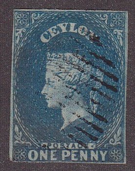
Lately I have been noticing a lot of stamp issues with maps on them as I count the stamps that make up the International Part II album. Just finished going through the album to build a count of items per each country.
I, also, started the album filling process by moving stamps into the first country for which I finished the checklist that I am building for the album which was the easy one, the USA. It surprised me that the USA portion includes the Duck stamps plus some revenue stamps and a few cut squares and an airmail letter sheet. I, almost, managed to fill the 1940-49 issues from duplicates with mint or unused stamps except for the surprise issues. Next, on to Aden to build a checklist.
Login to Like
this post
I like to draw Tolkien-style maps of fantasy places.
This is the Isle of Wole I drew a few years ago. It will take a while to clean it up and make it into a digitized map but I also love making up stories about the places of the map, draw trade routes, local histories, natural resources, etc.

2 Members
like this post.
Login to Like.
Hi Everyone;
I like maps also, especially ship's navigation maps, complete with depth soundings and the wiggley lines representing the changes in depth of the sea bottom.
If you have never seen one, rent the movie "Hunt For Red October". This movie shows scenes of a navigator plotting a course thru the deep ocean channels at the bottom of the sea bed.
When I was in the US Navy, I was frequently assigned watches in the pilot house, steering the ship and watching the compass, keeping us on course. When the weather was fair and it got boring, I would watch the Yeoman (navigator) using parallel rulers, dividers and such to plot our course. I could easily tell where we were and approximately when we would make a course change. It kept me from falling asleep. 
I have a three piece custom framed by me, wall hanging group. the center frame holds a navigation chart of the US Virgin Islands (honeymoon location 1st wife).
The left frame depicts the Bonhomme Richard. She was originally an East Indiaman. The ship Captained by John Paul Jones, given to us by France.
The right frame depicts the Bonhomme Richard, engaged in battle with the HMS Serapis. When given the conditions of surrender, John Paul Jones said "I have not yet begun to fight".
If you can't find the video Red October, you can see a navigator's chart HERE.
Fair winds and smooth sailin'....
TuskenRaider
Login to Like
this post
I grew up in Dutchess County which is the county south of Phil's. My dad had a cabin cruiser, and we took it out on the Hudson River most weekends in the summer. My dad had US Coast Guard navigation maps. I loved to look over them seeing the river depth, channels, railroad lines along the river, and I looked intensely for each ship wreck noted on the maps. When we were in the vicinity of a wreck, I'd get out the binoculars to take a look.
I have always liked looking at maps. In addition to the water navigation maps, I like to study battle and military maps.
When going on a road trip, I study road maps for hours picking out the way to go. Some older maps will show local attractions. I cross check with my 1980 road atlas (it replaced my 1972 atlas) that I bought and have continuously used to black line (marked with a Sharpie) the roads that I have driven, to select new roads to drive.
1 Member
likes this post.
Login to Like.

Auctions
I picked up this map when we dropped some things off at an A.S.P.C.A. thrift..i saw how tiny my world was 1950-58 probably 15 miles from Clermont to Hudson. Of course it took me many many years to realize what a magical place it was.
Login to Like
this post

re: Anyone into maps ?
I never got into GPS and have always relied on a map - but maps on stamps are a passion for me.
1 Member
likes this post.
Login to Like.

re: Anyone into maps ?
My father is a civil engineer and worked for the Panama Canal. Maps were always around.
Login to Like
this post

Auctions
re: Anyone into maps ?
Phil, your map must be 1963 or later, as ZIP was introduced in July 63 and your map showcases the ZIPs of Columbia County
Login to Like
this post

re: Anyone into maps ?
As a kid I was obsessed with the maps of one particular fantasy world:
LOTR
Interactive LOTR Map
2 Members
like this post.
Login to Like.
11:24:08pm
re: Anyone into maps ?
Although not an active collector, if I come across any General Drafting maps (Esso/Exxon), especially for the northeast US, I will buy it. They were consistently the best, clearest, and most accurate maps given out by a gas station.
I once wrote Esso and asked if they would send me a complete set of US maps, and the did! Two small boxes full! (Alas, most disappeared back in the 70's when my parent moved out of my boyhood home.
Hagstrom maps are another fave of mine!
Geoff
1 Member
likes this post.
Login to Like.

re: Anyone into maps ?
Lately I have been noticing a lot of stamp issues with maps on them as I count the stamps that make up the International Part II album. Just finished going through the album to build a count of items per each country.
I, also, started the album filling process by moving stamps into the first country for which I finished the checklist that I am building for the album which was the easy one, the USA. It surprised me that the USA portion includes the Duck stamps plus some revenue stamps and a few cut squares and an airmail letter sheet. I, almost, managed to fill the 1940-49 issues from duplicates with mint or unused stamps except for the surprise issues. Next, on to Aden to build a checklist.
Login to Like
this post
re: Anyone into maps ?
I like to draw Tolkien-style maps of fantasy places.
This is the Isle of Wole I drew a few years ago. It will take a while to clean it up and make it into a digitized map but I also love making up stories about the places of the map, draw trade routes, local histories, natural resources, etc.
2 Members
like this post.
Login to Like.

re: Anyone into maps ?
Hi Everyone;
I like maps also, especially ship's navigation maps, complete with depth soundings and the wiggley lines representing the changes in depth of the sea bottom.
If you have never seen one, rent the movie "Hunt For Red October". This movie shows scenes of a navigator plotting a course thru the deep ocean channels at the bottom of the sea bed.
When I was in the US Navy, I was frequently assigned watches in the pilot house, steering the ship and watching the compass, keeping us on course. When the weather was fair and it got boring, I would watch the Yeoman (navigator) using parallel rulers, dividers and such to plot our course. I could easily tell where we were and approximately when we would make a course change. It kept me from falling asleep.
I have a three piece custom framed by me, wall hanging group. the center frame holds a navigation chart of the US Virgin Islands (honeymoon location 1st wife).
The left frame depicts the Bonhomme Richard. She was originally an East Indiaman. The ship Captained by John Paul Jones, given to us by France.
The right frame depicts the Bonhomme Richard, engaged in battle with the HMS Serapis. When given the conditions of surrender, John Paul Jones said "I have not yet begun to fight".
If you can't find the video Red October, you can see a navigator's chart HERE.
Fair winds and smooth sailin'....
TuskenRaider
Login to Like
this post

re: Anyone into maps ?
I grew up in Dutchess County which is the county south of Phil's. My dad had a cabin cruiser, and we took it out on the Hudson River most weekends in the summer. My dad had US Coast Guard navigation maps. I loved to look over them seeing the river depth, channels, railroad lines along the river, and I looked intensely for each ship wreck noted on the maps. When we were in the vicinity of a wreck, I'd get out the binoculars to take a look.
I have always liked looking at maps. In addition to the water navigation maps, I like to study battle and military maps.
When going on a road trip, I study road maps for hours picking out the way to go. Some older maps will show local attractions. I cross check with my 1980 road atlas (it replaced my 1972 atlas) that I bought and have continuously used to black line (marked with a Sharpie) the roads that I have driven, to select new roads to drive.
1 Member
likes this post.
Login to Like.